登录后查看更多精彩内容~
您需要 登录 才可以下载或查看,没有帐号?立即注册


x
本帖最后由 hillside 于 2014-5-1 12:05 编辑
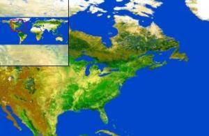
http://eusoils.jrc.ec.europa.eu/
Welcome to the European Soil Portal This European Soil Portal is an integral part of the European Soil Data Centre, which is one of the ten environmental data centres in Europe and is the focal point for soil data at European level. This European Soil Portal contributes to a thematic data infrastructure for soils in Europe. It presents data and information regarding soils at European level. It connects to activities within JRC concerning soil (JRC SOIL Action). It serves also as a vehicle to promote the activities of the European Soil Bureau Network. Spatial data collection and processing within this infrastructure is performed according to emerging ideas behind the INSPIRE (Infrastructure for Spatial Information in Europe) initiative.
- Soil Datasets: The European Soil Portal contains currently many soil data, maps, information, Atlases and applications; most of the offered data are at European scale, while, when possible, links to national or global datasets are provided.
- Soil at JRC: Soil activities within the JRC are concentrated in a specific JRC Action, called FP7 "Soil Data and Information Systems" or SOIL. Thematic Assessement Soil in the "State of Environment Report (SOER2010) is also available.
- Documents - Publications: European Soil Bureau Research Reports, JRC Scientific and Technical Reports, Papers in Journals, Publications in Conferences, Posters and Publications in CD-ROMs, Glossary of Soil Terms.
- Soil Projects: many past and current projects relate to the soil activities of JRC .
- Soil Themes: covers various results for different soil themes such as Erosion, soil Organic Carbon Content, Salinisation, Landslides, Soil Compaction, Biodiversity and soil Contamination.
- European Soil Bureau Network (ESBN): is a network of soil institutes supporting the JRC soil activities
- International Cooperation: presents the most Important International Cooperations that Soil Action is participating (Global Soil Partnership, Global Soil Biodiversity Initiative, GlobalSoilMap.net, Sino-EU Panel on Land and Soil)
- Events - Presentations in various events(Conferences, Workshops, Meetings, Summer Schools) which are related to the work that the Land Management Unit is doing in relation to the European Soil Bureau Network. Calendar of future events is also available.
- Awareness Raising Our Goal as Soil Action is to Establish an action plan for the development of measures/programmes/initiatives to raise awareness of the importance of soil across European society (i.e. policy makers, general public, universities, schools, industry, etc.).
- What's new? chronology of items added to this soil portal. Get the NEWS in XML format and the monthly Newsletters.
- Utilities - Various: A mailing list has been set up in order to keep interested persons up to date with the latest contents on this site. Other Tools such as the Search Engine are also available.
- Team - Action SOIL: the people at JRC behind the soil activities.
- Links: key pointers to soil related bodies and International Organisations
|
http://esdac.jrc.ec.europa.eu/
WELCOME TO THE EUROPEAN SOIL DATA CENTRE The European Soil Data Centre (ESDAC) is the thematic centre for soil related data in Europe. It's ambition is to host and point to relevant soil data and information at European level. It consists of two main elements. A catalogue of soil resources and a map viewer into some of the soil data hosted at the ESDAC. The catalogue of soil resources is a light-weight metadata system that describes and points to various soil resource types: datasets, services/applications, documents, events, projects and external links. The ESDAC map viewer allows the user to navigate in key soil data for Europe. Main data come from the European Soil Database.
http://eusoils.jrc.ec.europa.eu/library/esdac/OnLine_Data.cfmSoil Datasets > Data > Data Inventory > Download dataInventory of available data (for downloading) at ESDAC - Number of Datasets: 32[size=0.75em]Data that are freely available for download while other are restricted due to copyright rules (Registration is requested).
European Soil Database| Dataset | Registration needed(Yes/No) | Short Comments | Information Link | | European Soil Database (ESDB) v2.0, Download Data | Registration is requested | 73 attributes (vector format) | More info.... | | European Soil Database Raster Library 1kmx1km, Download Data | Registration is requested | 73 raster files | More info.... | | Data for the Soil Information System for the MARS Crop Yield Forecasting System, Download Data | Registration is requested | | More info.... | | ESDB Derived data, Download Data | Registration is requested | ESDB derived data: Total available water content, Depth available to roots, Clay, Silt, Sand, Organic carbon, Bulk Density, Coarse fragments | More info.... | | European Soil Database – Raster Library 10kmx10km, Download Data | Freely available | 73 raster of 10kmx10km | |
Soil Point| Dataset | Registration needed(Yes/No) | Short Comments | Information Link | | Soil Profile Analytical Database 2, Download Data | Registration is requested | | More info.... | | LUCAS Topsoil 2009 data, Download Data | Registration is requested | LUCAS: Land Use/Cover Area frame Statistical Survey . 19,967 geo-referenced samples distributed in 25 countries | More info.... | | Soil Profile Analytical Database of Europe of Measured parameters , Download Data | Freely available | 560 measured profiles | |
Soil Threats| Dataset | Registration needed(Yes/No) | Short Comments | Information Link | | Pan European Soil Erosion Risk Assessment data (from the PESERA project), Download Data | Registration is requested | Soil Erosion | More info.... | | Topsoil Organic Carbon for Europe, Download Data | Registration is requested | Soil Organic Carbon | More info.... | | Natural Susceptibility of Soils to Compaction in Europe, Download Data | Registration is requested | Soil Compaction | More info.... | | Saline and Sodic Soils in the European Union, Download Data | Registration is requested | Soil Salinization | More info.... | | Soil pH in Europe, Download Data | Registration is requested | Soil Acidification | More info.... | | Soil Erosion Risk Assessment in Europe (MESALES Model), Download Data | Registration is requested | Soil Erosion | More info.... | | Soil Erodibility (K-Factor) in Europe, Download Data | Registration is requested | Soil Erosion | More info.... | | Global Soil Organic Carbon Estimates, Download Data | Registration is requested | Soil Organic Carbon | More info.... | | Rainfall Erosivity in Switzerland and Application(Code) for Calculation of R-Factor, Download Data | Registration is requested | Soil Erosion | More info.... | | Wind Erosion - - Agriculture Field Parameters, Download Data | Registration is requested | Soil Erosion / Wind Erosion | More info.... | | European Landslide Susceptibility Map , Download Data | Registration is requested | Landslides | More info.... | | Pan-European Soil Organic Carbon (SOC) stock of agricultural soils, Download Data | Registration is requested | Soil Organic carbon Stocks in Agricultural Soils | More info.... | | Erosion in Italy & Assessment of forest lands, Download Data | Registration is requested | Erosion in Italy (USLE) and assessement of Forest lands | More info.... | | Progress in the management of contaminated sites - EIONET data collection 2011, Download Data | Freely available | Data on contaminated sites after the EIONET 2011 data collection | | | Heavy metals in European soils, Download Data | Freely available | 8 heavy metals (arsenic, cadmium, chromium, copper, mercury, nickel, lead and zinc) | |
Projects data| Dataset | Registration needed(Yes/No) | Short Comments | Information Link | | GroundWater Resources, Download Data | Registration is requested | catalogue national water resources | More info.... | | Spatial Layers for Estimating Soil GHG Emissions from ILUC due to the Production of Biofuels, Download Data | Registration is requested | Climate and Ecological Zones, Soil Default C-Stocks, Land Use System Factor(FLUSYS), IFPRI Global Regions, Crop Surface Area | More info.... | | European Food Agency Data (EFSA) Data, Download Data | Registration is requested | Organic matter content, pH, Bulk density, Texture, Water content at field capacity | More info.... | | G2 soil erosion model data: Crete (Greece) and Strymonas (Greece/Bulgaria), Download Data | Registration is requested | G2 soil erosion model data | More info.... | | Interactions between soil related sciences (iSOIL), Download Data | Registration is requested | Geophysics Gamma Spectrometry, EMI, EM38D, Magnetics | More info.... | | Climate Change Regional Indicators of Change and Extremes, Download Data | Registration is requested | Indicators on Climate Change: temperature, Precipitation, Precipitation intensity, Relative Humidity, Aridity Index, Humidex...etc | More info.... | | Eco-pedological Map for the Alpine Territory (ECALP), Download Data | Freely available | Alpine zone data | | | Support to Renewable Energy Directive, Download Data | Freely available | Climatic and Soil Type layers | | | Biochar Meta-analysis Database, Download Data | Freely available | Biochar project data outputs. | |
http://www.cnetnews.com.cn/2008/0320/777650.shtml
欧洲公布迄今最高分辨率全球土壤覆盖图(图)
作者: 新浪科技
CNETNews.com.cn
2008-03-20 20:54:01
关键词: 土壤
北京时间3月21日消息,据国外媒体报道,在意大利首都罗马举行的一次国际会议上,欧洲航天局和联合国粮农计划署共同展示了最新绘制的世界地图。该地图根据最新拍摄的卫星图片绘制而成,分辨率超过以往任何地图至少10倍以上。 过去,科学家们曾从太空绘制过地球的土地覆盖图,而此次绘图的分辨率是以往任何一次绘图的10倍,将于7月份大会结束后与公众见面。为了利用数据绘制全球土地覆盖趋势图,研究自然和人工生态系统并模拟气候变化范围及影响,科学家们为此次最新绘制的土地覆盖图欢呼,并称其具有“里程碑”意义。 欧盟委员会联合研究中心的弗雷德里克-阿查德说:“全球土地覆盖系统是我们在测绘全球土地覆盖领域的一大进步,我们可以用前所未有的更高分辨率和更详细的主题主容进行图样绘制。”比利时天主教鲁汶大学设计该土地分类程序的皮埃尔-德弗尼教授说:“此次最新的全球土地覆盖系统产品不仅仅是一幅地图,它还是首个全球级自动土地覆盖测绘的操作型科技展示,可以为地区气候建模所需的土地表面状态提供详细精准的描绘。”联合国粮食与农业组织的约翰-拉塔姆称:“要有效进行自然资源、环境保护、食品安全、气候变化以人文项目管理,就必须掌握大量的土地覆盖数据。此次全球土地覆盖图将是首个分辨率为300米的免费产品,因此,对社会利益群体而言是一个里程碑产品。” 该图是以图像的20千兆字节绘制的,相当于2000万本书的内容,其数据由搭载在Envisat卫星上的中等分辨率成像分光计于2005年5月至2006年4月期间获取,所有图像都使用了标准加工技术。图中共展示了22种不同的土地覆盖类型,其中包括农田、沼泽、人造地表、水体和永久积雪和冰冻地。为了使用用户最大程度受益,该图的主题图例与联合国土地覆盖分类系统兼容。(刘妍)
|


 窥视卡
窥视卡 雷达卡
雷达卡
 发表于 2014-5-1 10:16:09


 提升卡
提升卡 置顶卡
置顶卡 沉默卡
沉默卡 喧嚣卡
喧嚣卡 变色卡
变色卡 抢沙发
抢沙发 千斤顶
千斤顶 显身卡
显身卡